we are ready to help you

Impacting Lives with Smart
GIS & Mapping Solutions

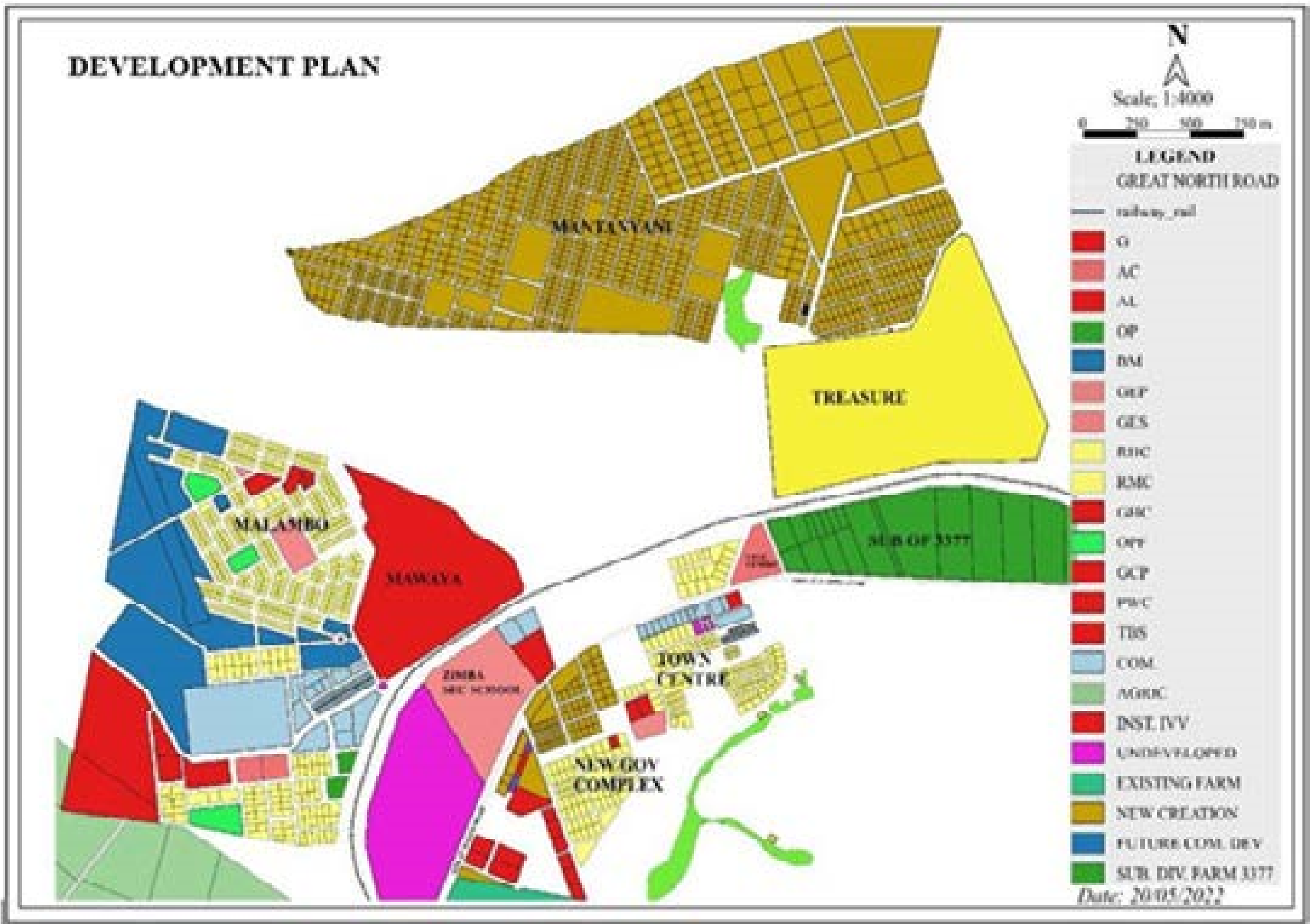
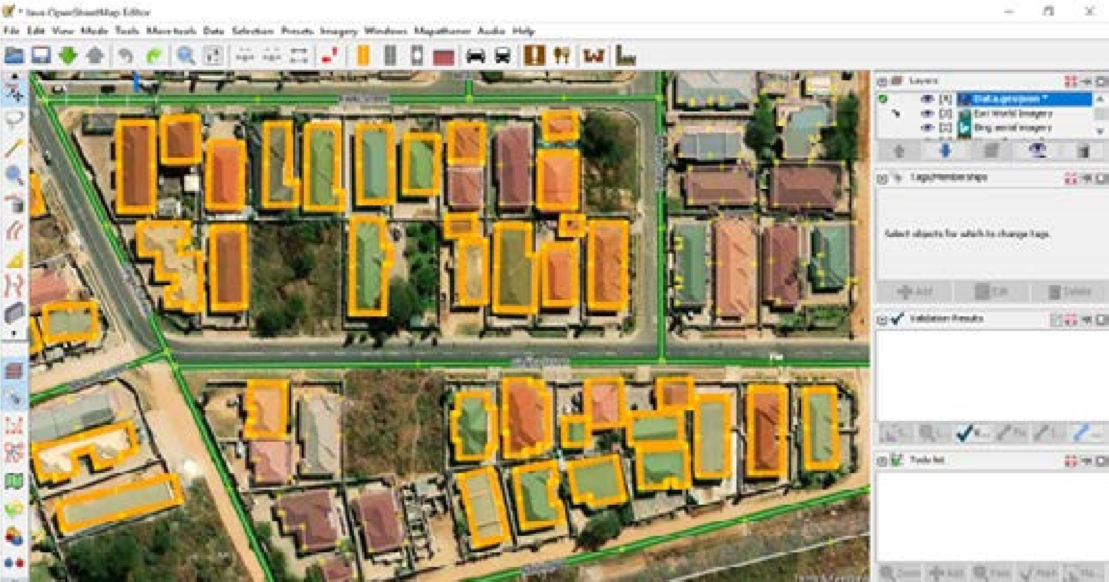
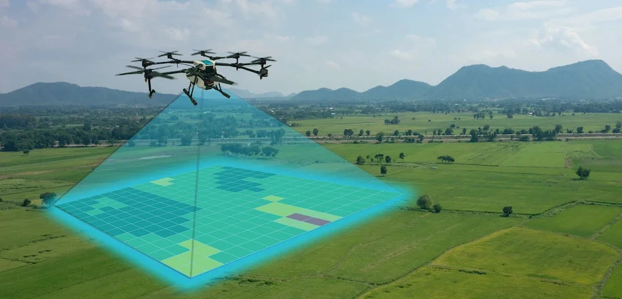
Smart Solutech provides Geographic Information Systems (GIS) and Mapping solutions to businesses, government, and organizations of all sizes. We transform data into insights through mapping, analysis, and visualization.

contact us
we are here to support you

Professional GIS
& Data Solutions

Our team is composed of skilled professionals in Geospatial Technologies, Data Science, Land Surveying, Agriculture, Environmental and Public Health. We bring energy, ideas, and pride to every project.

our services
we have a solid background

3+ Years of Professional
& Trusted Experience

Locally owned Zambian company with fast and flexible service delivery. We provide transparent and competitive pricing with 100% customer satisfaction guaranteed.

learn more

Need GIS & Mapping Solutions?

Contact us today for professional geospatial services tailored to your needs.

GIS & Mapping Services

Transform data into insights through mapping, analysis, and visualization

Geodatabase Development

Centralized data storage and management system for GIS, supporting multiple datasets such as satellite images, GPS data, CAD files, and survey measurements.

Read More

Remote Sensing & Mapping

Satellite imagery collection and monitoring of Earth's physical characteristics — used for environmental management, deforestation tracking, and land-use planning.

Read More

Drone Mapping Services

Use of drones and photogrammetry to capture high-resolution imagery, producing accurate 2D maps and 3D models for construction, agriculture, and surveying projects.

Read More
Why Choose Smart Solutech

Our solutions for your project success

Locally owned and quick to respond with professionally trained technicians. We provide fast and flexible service delivery with 3+ years of professional experience.

Transparent and competitive pricing with 100% customer satisfaction guaranteed. We make Smart Solutech a reliable and trusted partner.

Read More
500+
Projects Done
100%
Satisfaction Rate
3+
Years Experience
11
Service Areas
Who we are

Get to know about Smart Solutech

Smart Solutech is a locally owned Zambian company providing Geographic Information Systems (GIS) and Mapping solutions across multiple sectors. We help organizations manage and analyze data, create maps, and visualize insights that improve planning and development.

Our mission is to become a leading provider of GIS, Mapping, and IT services in Zambia while establishing ourselves as a company of integrity and excellence.

Read More

Our Team

meet our dedicated professionals
Portrait of Damiano Mwalapila

Damiano Mwalapila

Project Manager

"Project manager coordinating GIS and mapping work—planning delivery, timelines, and clear communication from kickoff through handover."

Portrait of Mwape Chishala

Mwape Chishala

IT Manager

"IT manager overseeing infrastructure, tooling, and data systems—keeping our GIS workflows secure, reliable, and ready for delivery."

Portrait of Nicholas Chipanta

Nicholas Chipanta

GIS Officer

"GIS officer handling maps, spatial data, and operational GIS tasks—supporting analysis, QA, and reliable outputs for every project."

Request a consultation

Get in touch for professional GIS and mapping solutions